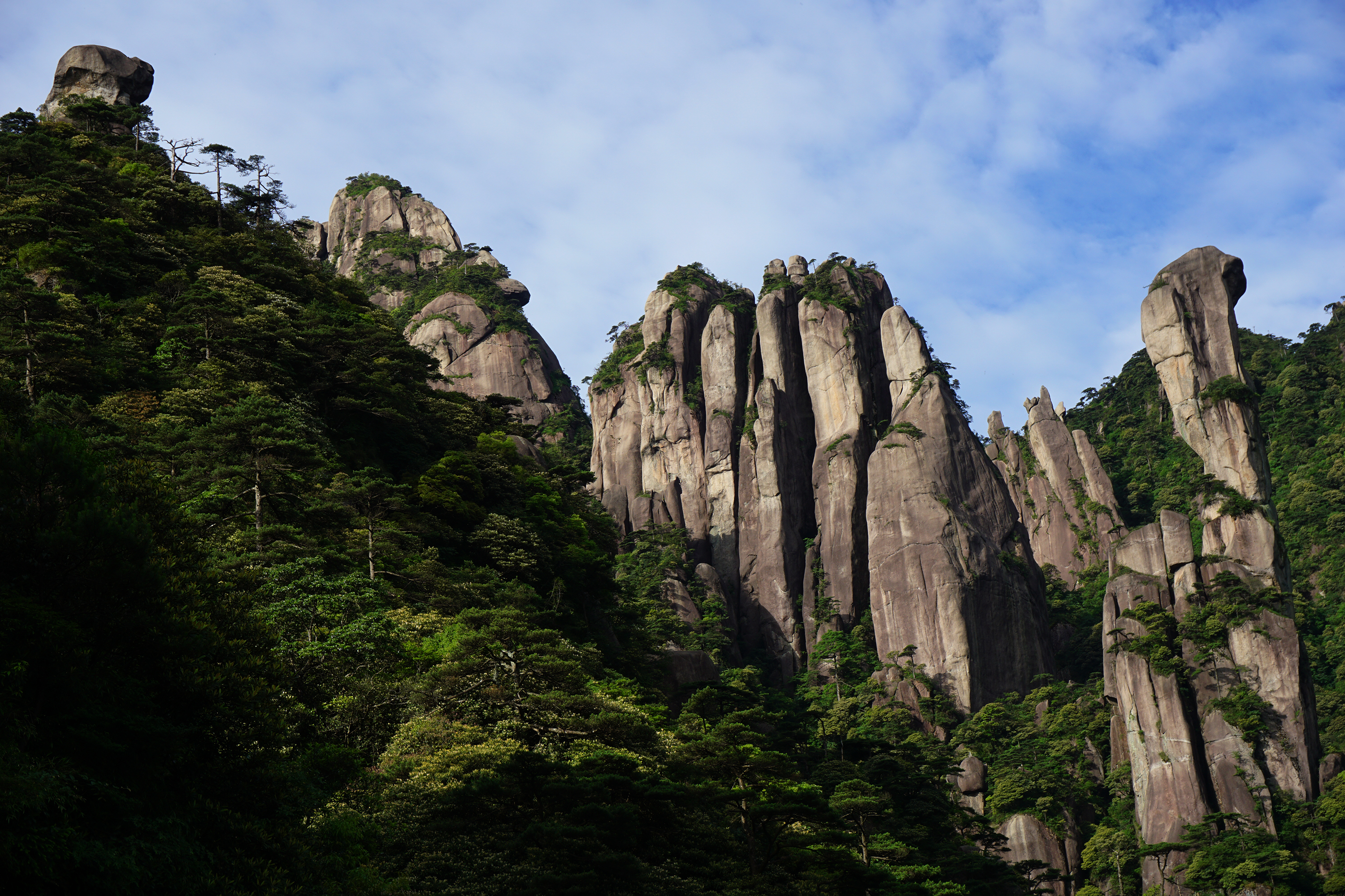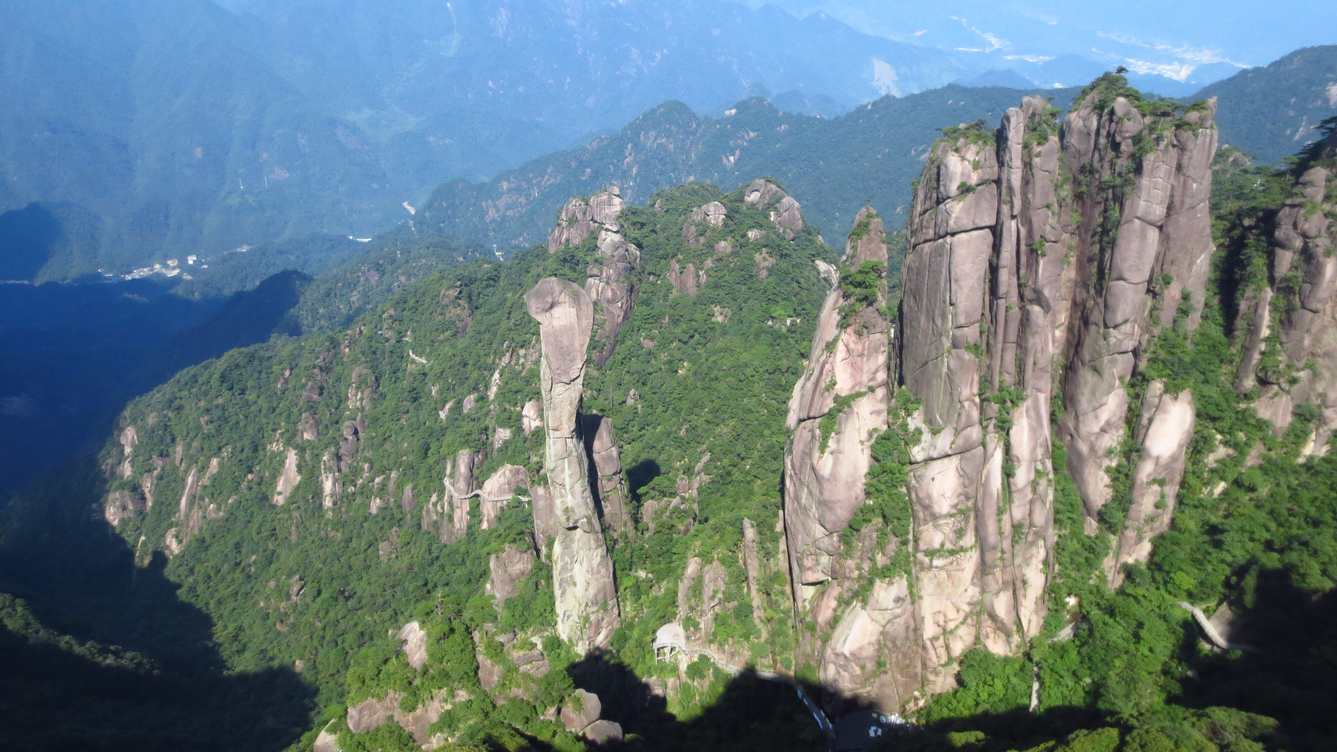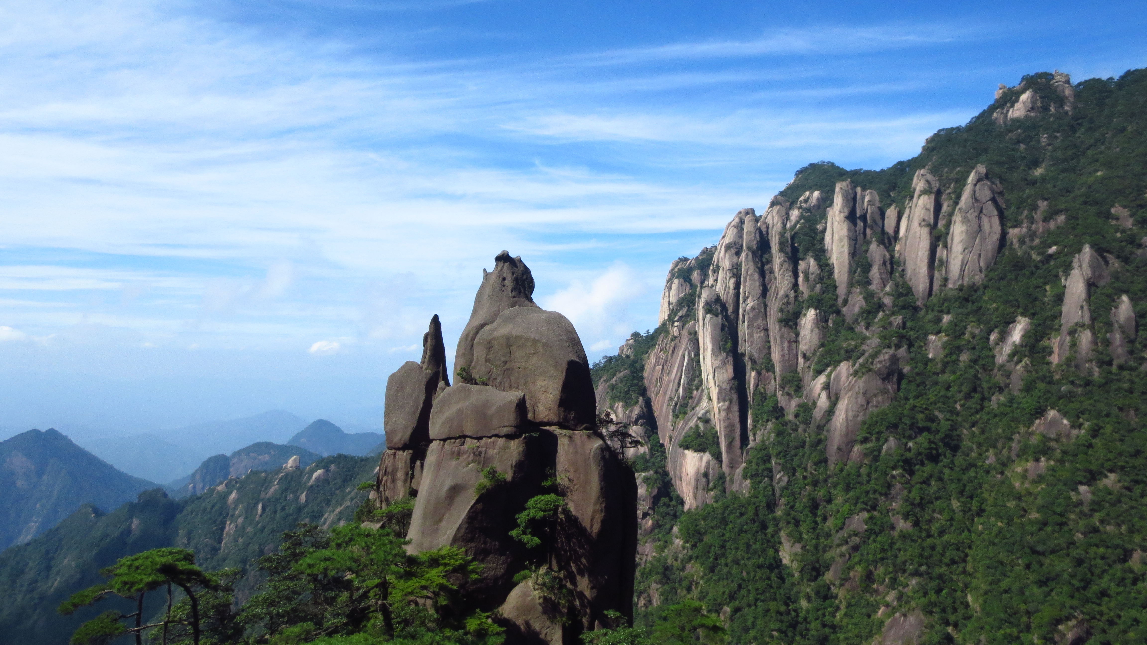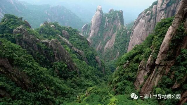
Due to the long-term effects of internal and external geological forces of the Earth, Sanqingshan has steep terrain on its east, south, and west sides, while the north and south sides are relatively gentle. In the central area, from the foot to the top of the mountain, the horizontal distance is 5 kilometers, and the elevation rises sharply from over 200 meters to more than 1,800 meters, resulting in a large topographic difference. There are 10 main types of landforms. Among them, there are 5 genetic types: tectonic erosion type, tectonic denudation type, fluvial erosion and denudation type, fluvial accumulation type, and gravity collapse accumulation type; and 5 morphological types: mid-mountain, low mountain, hill, intermountain basin, and small river valley plain. The park is a mountainous area centered on a large granite massif, with highly developed micro-landforms within the granite body, showing diverse forms. These include 11 types: peaks, peak walls, peak clusters, peak forests, stone forests, peak pillars, stone cones, cliffs, gorges, sculpted stones, and caves. It is a rare micro-landscape wonder in granite worldwide and serves as a typical example for studying and showcasing the landscape and formation evolution process of granite micro-landforms, with outstanding scientific value. The following briefly introduces several macroscopic landforms.
Overview of Landforms
Due to the long-term effects of internal and external geological forces of the Earth, Sanqingshan has steep terrain on its east, south, and west sides, while the north and south sides are relatively gentle. In the central area, from the foot to the top of the mountain, the horizontal distance is 5 kilometers, and the elevation rises sharply from over 200 meters to more than 1,800 meters, resulting in a large topographic difference. There are 10 main types of landforms. Among them, there are 5 genetic types: tectonic erosion type, tectonic denudation type, fluvial erosion and denudation type, fluvial accumulation type, and gravity collapse accumulation type; and 5 morphological types: mid-mountain, low mountain, hill, intermountain basin, and small river valley plain. The park is a mountainous area centered on a large granite massif, with highly developed micro-landforms within the granite body, showing diverse forms. These include 11 types: peaks, peak walls, peak clusters, peak forests, stone forests, peak pillars, stone cones, cliffs, gorges, sculpted stones, and caves. It is a rare micro-landscape wonder in granite worldwide and serves as a typical example for studying and showcasing the landscape and formation evolution process of granite micro-landforms, with outstanding scientific value. The following briefly introduces several macroscopic landforms. ...
Erosional Hill Landforms
At the peripheral areas of the geological park, such as below the Fenshui in the north and below Fenglin in the south, the elevation is generally below 500 meters, with only a few peaks exceeding 500 meters. The incision depth is about 100–200 meters, the slopes are gentle, the valleys are short and shallow, V-shaped, with ridges running east–west, and the overall form is rounded.
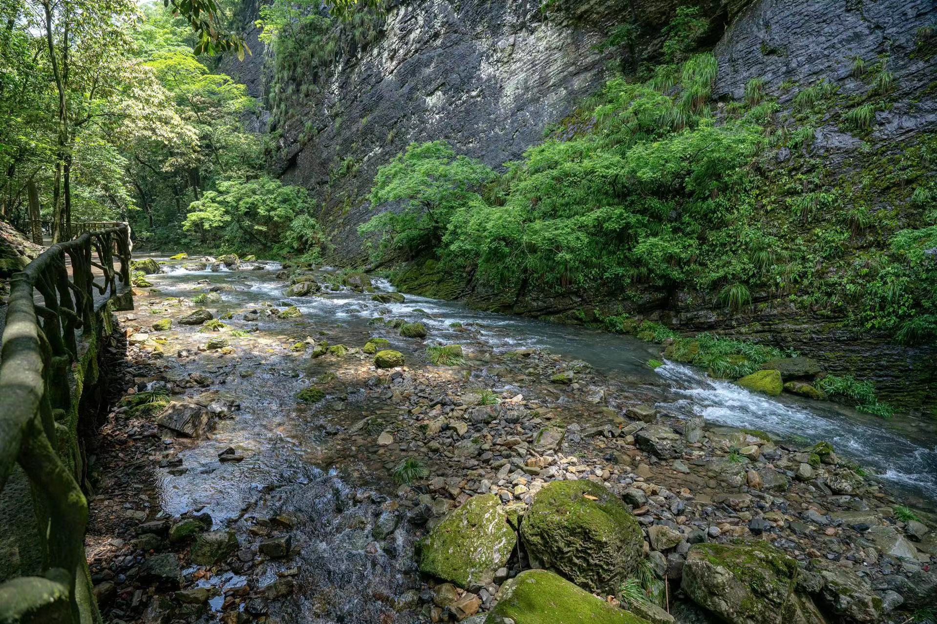
Fluvial Erosion, Abrasion, and Depositional Landforms
Due to the Quaternary fluvial and alluvial gravel deposits, such landforms can be seen in areas such as the upper Fen River, Beifangtang, Shuangxi, Fenglin, Zihu, Tongfang, and Houye. At the same time, there are two typical intermountain depressions. One is at an elevation below 450 meters, where large gravels with diameters of 10–15 meters are often seen, and the largest gravel reaches 30 meters, with good roundness. The other is the Sanqing Fudi depression, at an elevation of 1,450 meters, covering an area of hundreds of acres, which is a rare small basin on a mountain top. In addition, the park also features three intermountain rivers, namely the middle and upper reaches of the Jinsha River, Yuya River, and Fen River. Some sections serve as scenic river stretches and are suitable for rafting.
Constructive Erosion Hilly Landforms
The peripheral areas of the geological park, such as below the Fenshui River in the north and below the Fenglin area in the south, generally have an elevation of less than 500 meters, with only a few peaks exceeding 500 meters. The incision depth is around 100–200 meters, slopes are relatively gentle, valleys are short and shallow, V-shaped, with ridges running east-west, and the shapes are rounded.
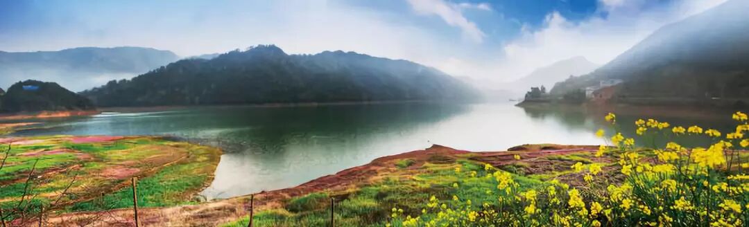
Mountain Basin
In the central area of Huaiyu Mountain Scenic Area in the Geological Park, it is surrounded by mountains over a thousand meters high, with a basin-shaped depression in between. The average elevation is over 900 meters, covering an area of 6.5 square kilometers. After evaluation by experts from the Chinese Academy of Sciences in geography and tourism, the Huaiyu Mountain Basin is the largest high-mountain basin in East China, and it is also the highest, largest in capacity, and coolest high-mountain summer resort in East China. It has rich cultural heritage resources and has now become a national youth education base.