The park is located in the junction of the Yangtze and Huaxia ancient plates in South China, at the northwest edge of the Huaiyu terrain and the southeast side of the Qin-Hang suture zone of ancient plates. Since the Mesozoic, it has been situated in the southeastern part of the Eurasian Plate and at the active margin of the western Pacific continent. It has successively experienced the Caledonian and Indosinian–Himingsi orogenies, followed by block uplift and faulting-dominated tectonics during the Yanshanian and Himalayan movements since the Mesozoic, resulting in a relatively complex geological structure.
(i) Fold Structure
The park is located in the core area of the Huaiyu Mountain compound anticline in northeastern Jiangxi. Multi-stage fold structures are developed in the rock strata, with the main macroscopic folds being:
Huangtuling Compound Anticline: Located in the northwestern part of the park around Huangtuling, it is part of the regional Huangtuling–Kaihua compound anticline. Its axis trends northeast, folds dip to the northeast and open to the southwest, extending about 15 km within the area. The axial plane is nearly vertical, and the strata on both limbs are relatively disordered. The northwest limb is steeper, with a strike of 30°-35° and a dip of 30°-75°, while the southeast limb is gentler, with a strike of 120°-150° and a dip of 30°-60°. The core strata are composed of Cambrian sediments, while the limb strata consist of Sinian–Ordovician sediments. The southern limb has wider exposure and often forms some secondary back-facing anticline structures.
Huamei Mountain Anticline: Distributed in the northeastern part of the park, its axis runs in a northeast-southwest direction. The southwestern end rises beside the Huaiyu Mountain rock mass, while the northeastern end extends upward through the source area. The axis strikes at 67°, with the northwestern limb being slightly steep, dipping at 40°-60°, and the southeastern limb being gentler, dipping at 30°-50°. The core strata belong to the Early Ordovician Yinzhu Bu Formation, while the limbs are composed of Late Cambrian strata.
Secondary folds within the park are abundant and diverse, especially common in the Lower Paleozoic and Neoproterozoic rock layers. They can be observed at both outcrop and specimen scales, varying in shape and size, with unique forms, offering considerable value for science education and tourism appreciation.
(ii) Fault Structures
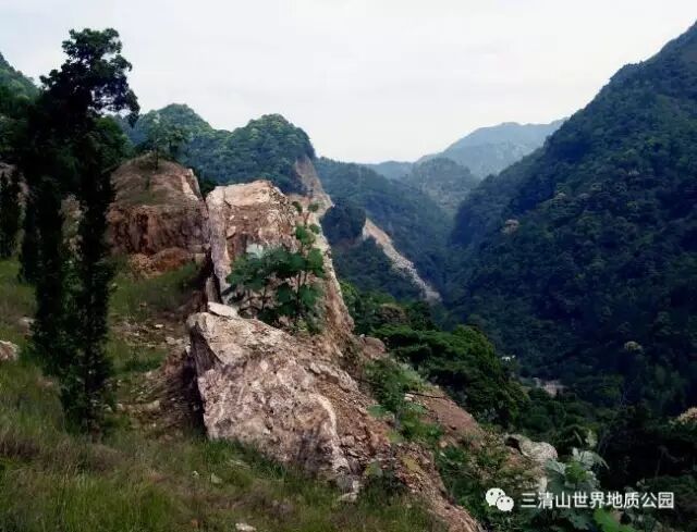
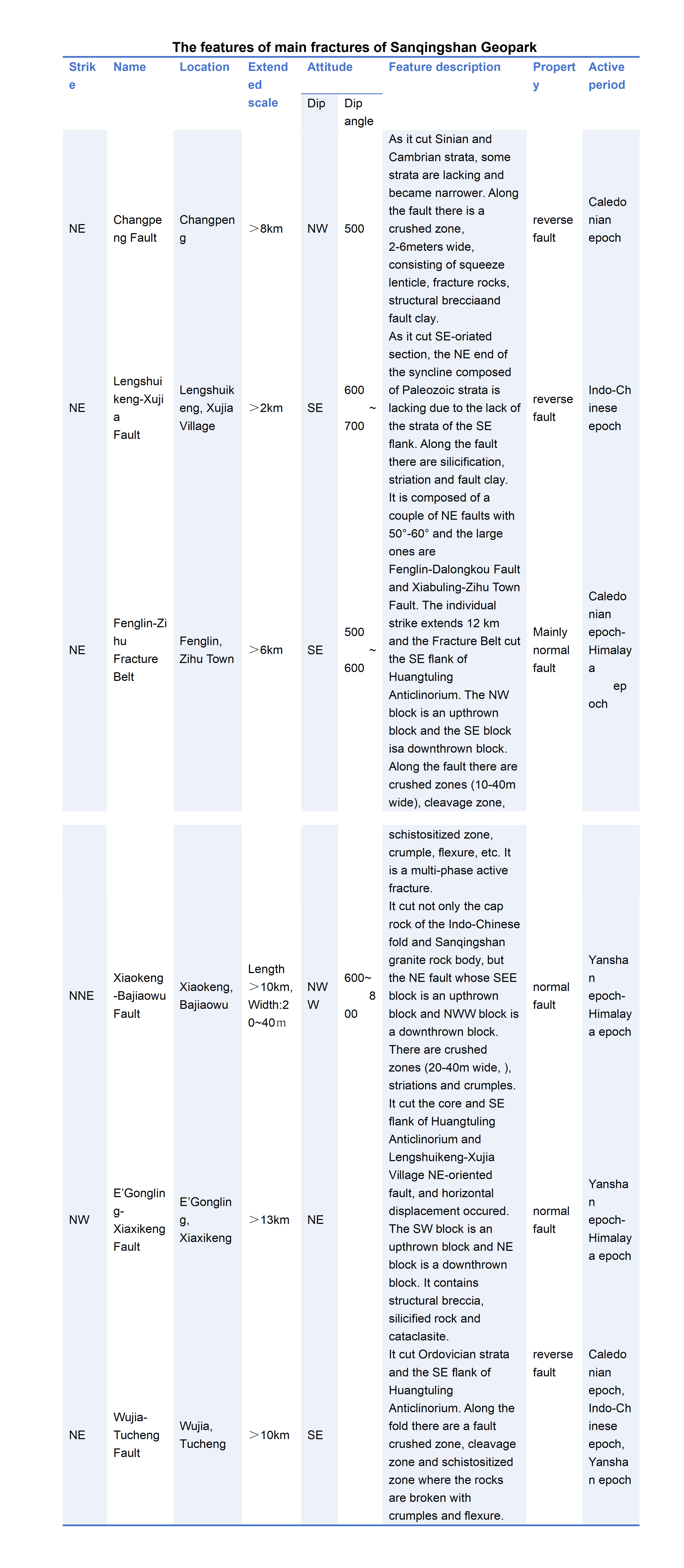
Fault structures are highly developed in the area (see the table below), with the main fault directions being northeastward, followed by north-northeastward and northwestward. In terms of formation time, the northeastward faults formed earliest, followed by north-northeastward faults, while the northwestward fault zones formed last. The main fault structures include normal faults and reverse faults. Among them, the Fenglin–Zihu fault zone, Xiaokeng–Bajiaowu fault, and Egongling–Xiaxikeng fault are mainly characterized as normal faults. These three faults slice the Sanqingshan, causing the main part of Sanqingshan to form the typical 'triangular block mountains.' Their dip angles range from 50° to 80°. Relative to the 'triangular block mountains,' their dip directions all tilt outward, meaning that the rocks or strata within the 'triangular block mountains' are the upthrown blocks, while those outside are the downthrown blocks. During the late Yanshanian period, magma intruded, cooled, and crystallized to form granite. In the era of 20–30 million years ago, the Himalayan orogeny occurred, namely the neotectonic movement, causing a significant uplift of the mountains. The Sanqingshan area also experienced a substantial overall uplift during this orogeny. Simultaneously, the previously formed faults experienced strong renewed activity, especially the Fenglin–Zihu fault zone, Xiaokeng–Bajiaowu fault, and Egongling–Xiaxikeng fault, which became even more active. During this intense activity, they once again significantly uplifted the 'triangular block mountains' centered on Yujing Peak, forming the topography with Yujing Peak as the highest point.
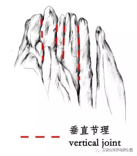
(iii) Joints
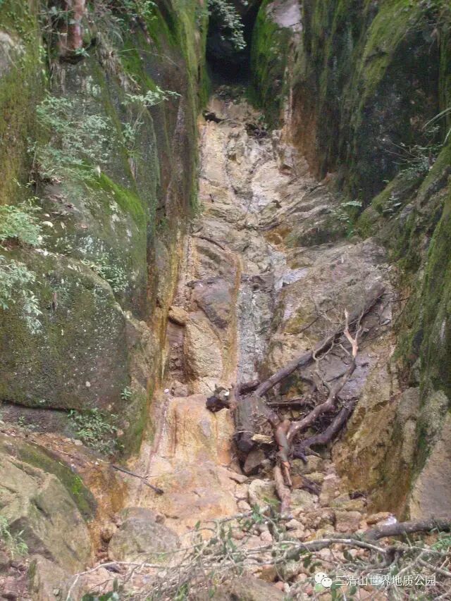
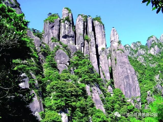
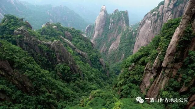
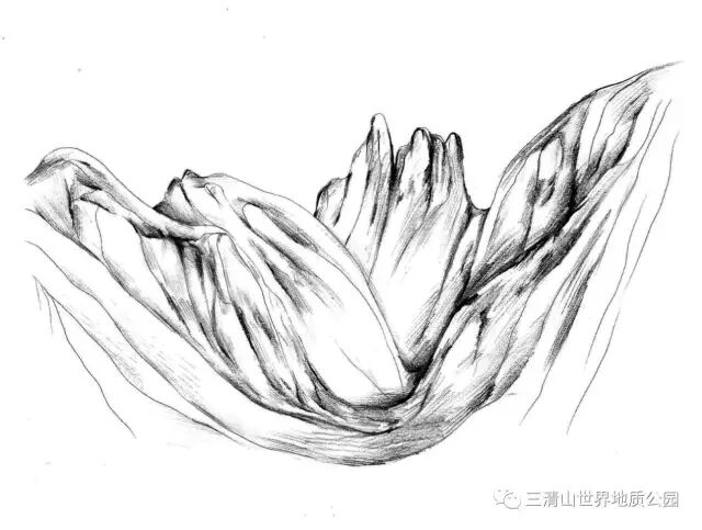
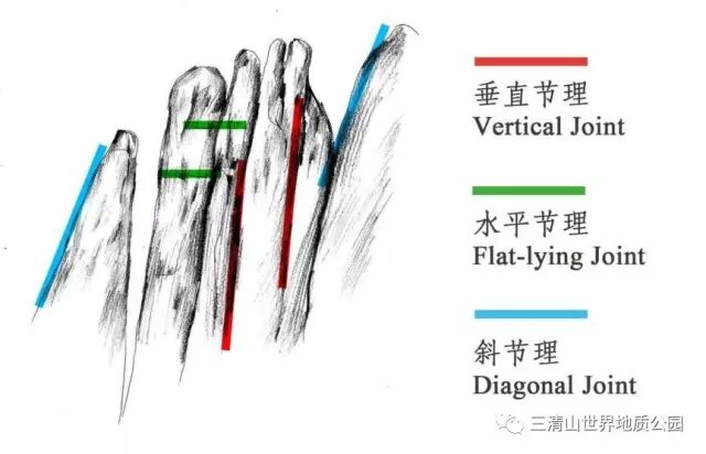
Common in various geological bodies, especially typical in granite bodies in park areas, mainly developing two sets of vertical joints. One set trends northeast to north-northeast, and the other trends northwest, forming a checkerboard pattern. The traces of joint structures can be seen in most granite peak forests. The former set trends from southwest to northeast, with an overall pattern that converges and then fans out, forming broom-like shapes on a macro scale, with large development and often exhibiting a banded distribution in space. It is the main structure controlling the western peak walls (such as Xihai Zhongqiang and Jiutian Jinping) and the southern gorges (such as Fushoumen and Yixiantian). The latter set generally trends northwest, slightly turning to nearly north-south in the southeast, gradually increasing in scale from north to south, and exhibiting a strip-like distribution; it is the main structure controlling the central granite pillars, southeastern peak walls, and some gorges. In addition, a set of near-horizontal joints develops within the park, which is the main control structure for shaped rock landscapes. These landscapes, including peak walls and pillars, are shaped through horizontal joint cutting and weathering erosion to form uniquely shaped scenery.