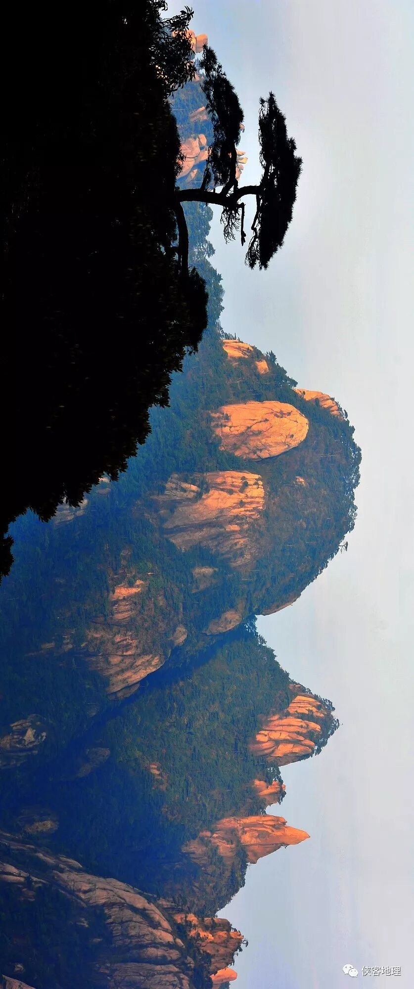
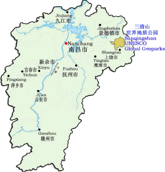
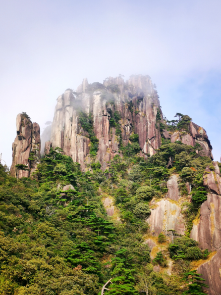
The Sanqingshan UGGp is located in Shangrao City of Jiangxi Province and divided into Sanqingshan Main Area, Huaiyushan Area and Zihu Area, covering a total area of 433km2. Its main peak, Yujing Peak, is 1819.9m a.s.l. It acquired its name thanks to its three peaks (Yujing Peak, Yuxu Peak and Yuhua Peak) and their resemblance to three seats for the three founders of Taoism, Yuqing, Shangqing and Taiqing. Sanqingshan joined the Global Geoparks Network in September 2012. It is a natural geographic area with abundant geological outcrops and distinctive landforms in the Southeast of China, principally consisting of Mesozoic granite, Paleozoic and Proterozoic strata.
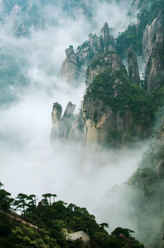
The Geopark is situated in the zone of conjunction between the Yangtze and Cathaysia paleoplates. As both a UNESCO Global Geopark and a World Natural Heritage Site, it is recognized to be a great work of geosciences, recording an Earth history spanning over 880 million years, remaining precious geoheritage of stratigraphical, petrological, tectonic, and geomorphological significance, harboring rare biotic communities that evolved through more than 200 million years. There are varied, typical and centralized granite micro-landforms. Furthermore, the unique blend of granite landforms, ecology and spectacular meteorological effects, provide the area with an exceptional natural beauty, making it an outstanding natural museum and representative of granite peak forest landscape. In addition, the harmonious coexistence of humans and nature for over one thousand years has left the Geopark with an important cultural heritage. Predominant are ancient Taoist architectural structures designed and located to reflect the Taoist philosophy of “harmony of human and nature”, and regarded as an open-air museum of Chinese Taoism ancient architecture.
Located in southeastern Eurasia, the Sanqingshan UGGp lies within the eastern mid-subtropical zone, near the western Pacific Ocean. It serves as the source of the Xin River, which flows into Poyang Lake within the middle reaches of the Yangtze River system, and also supplies headwaters for tributaries of both the Le’an River Basin and the Qiantang River Basin. The Geopark encompasses the highest peak of the Huaiyu Mountains and falls under the jurisdiction of Shangrao City, Jiangxi Province, China.
Its geographical coordinates range from 28°45′06″N to 29°01′08″N and 117°53′03″E to 118°13′20″E. The Geopark is situated 43km from Shangrao City, 107km east of Quzhou City in Zhejiang Province, 240km west of Nanchang City in Jiangxi Province, 227km north of Wuyishan City in Fujian Province, and 280km south of Huangshan City in Anhui Province.
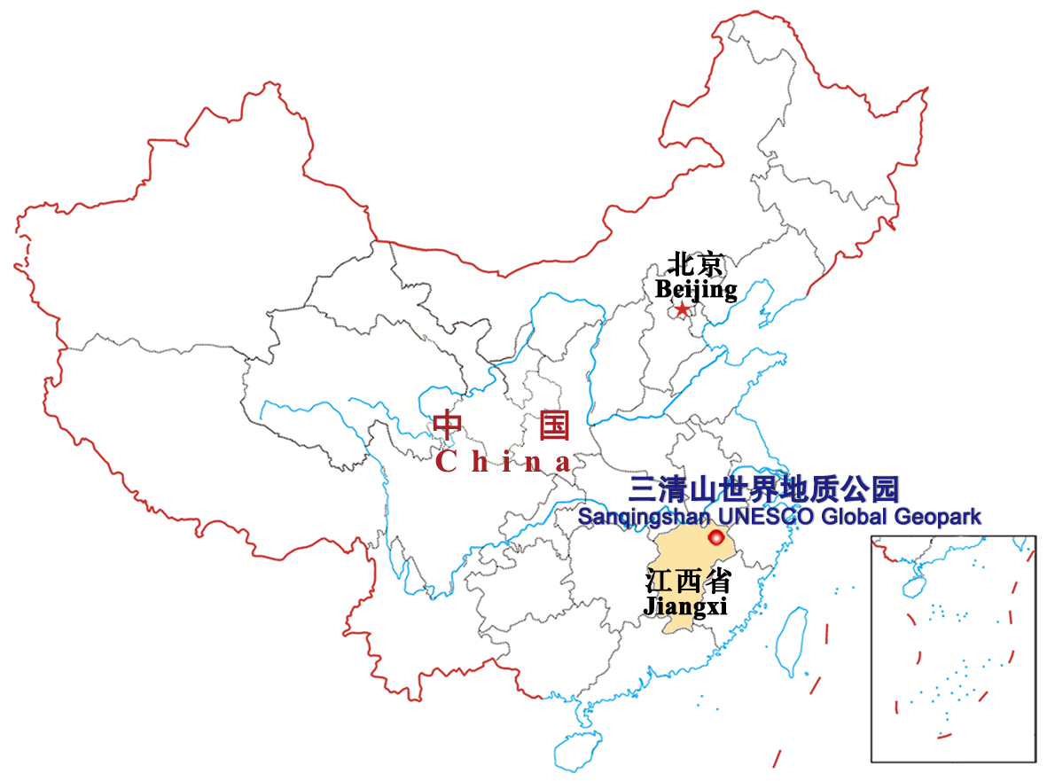
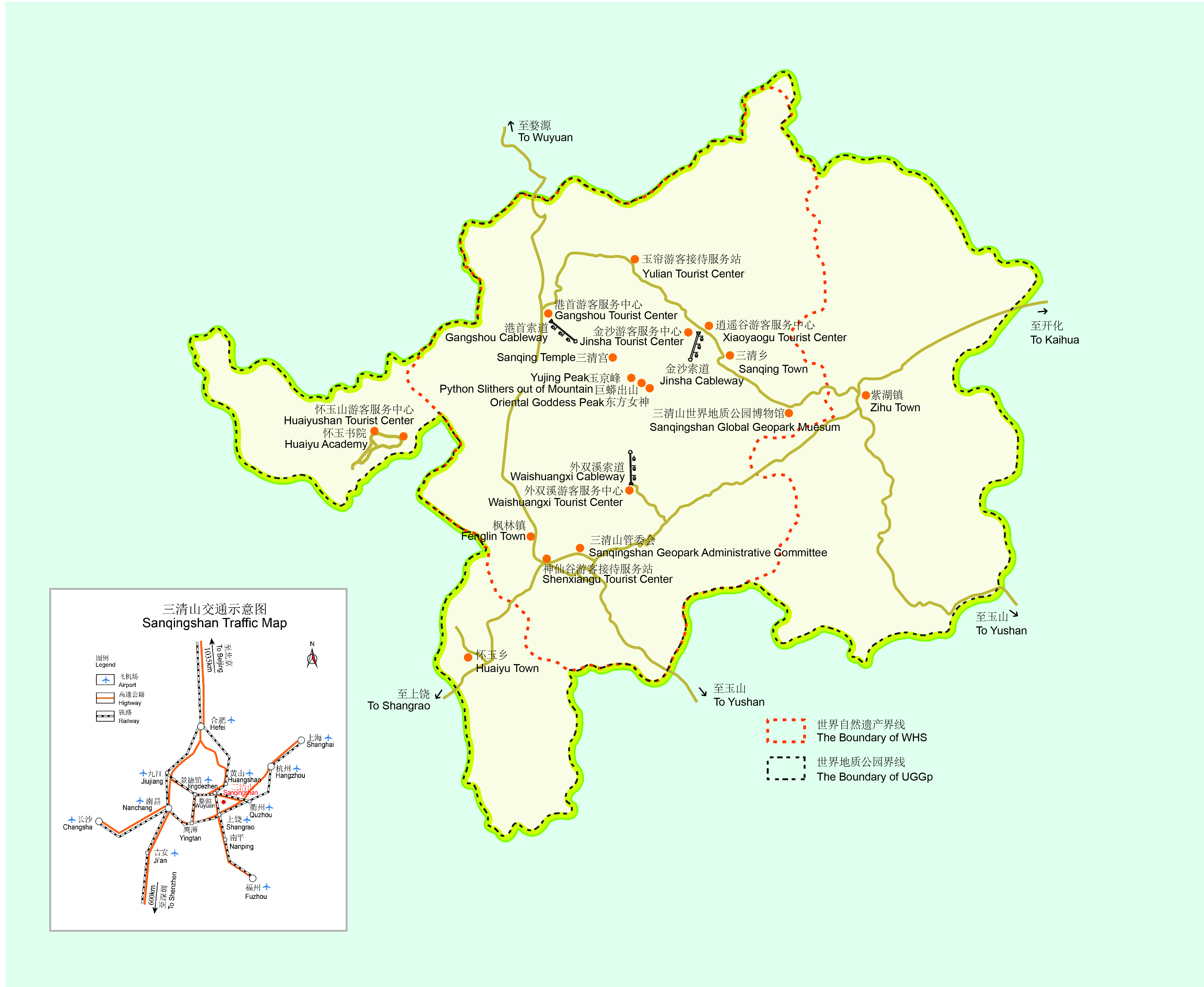
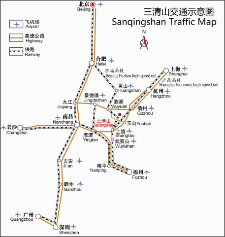
Sanqingshan is located at the junction of Yushan County and Dexing City in Shangrao City, Jiangxi Province, at the intersection of Jiangxi, Zhejiang, Fujian, and Anhui provinces. The surrounding transportation is highly convenient. Nearby highways, including the G60 Shanghai-Kunming Expressway (Liyuan-Wenzhou Section), G6021 Hangzhou-Changsha Expressway (Jingdezhen-Wuyuan-Huangshan Section), and National Highway G320, form an extensive road network. The Shanghai-Kunming Railway, Shanghai-Kunming High-Speed Railway, and Hefei-Fuzhou High-Speed Railway run through the area, connecting it to all directions. Shangrao Sanqingshan Airport, Jingdezhen Airport, and Quzhou Airport provide an aerial corridor. The coordinated development of highways, railways, and aviation has established a three-dimensional transportation network for tourism in Sanqingshan.
Note: The Liyuan-Wenzhou Expressway refers to the eastern section of the G60 Shanghai-Kunming Expressway (formerly Shanghai-Ruili Expressway) within Jiangxi Province. It starts at Liyuan (Jiangxi-Zhejiang border) in Yushan County, connecting to the Quzhou-Yaoli Expressway in Zhejiang Province, and ends at Wenjiazhen in Jinxian County, Jiangxi Province, where it links to the Wenjiazhen–Houtian Expressway. Stretching across the four cities of Shangrao, Yingtan, Fuzhou, and Nanchang, it has a total length of 245 kilometers.
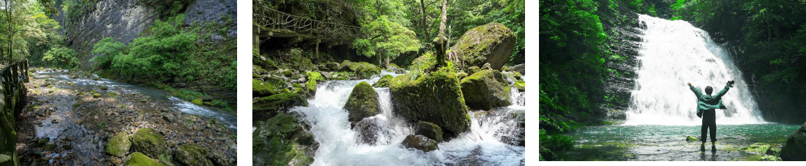
Sanqingshan is located in the headstream of Xinjiang River Basin of the Poyang Lake in the middle course of Yangtz River and the Qiantang River. River systems in the south of the park mainly flow into Poyang Lake through Xinjiang River and An’le River while river systems in the north of the park mainly flow into Qiantang River and the East China Sea. The surface water here is mainly valley stream and its primary source is rainwater. The surface water resource here differs distinctively in different seasons that in rainy seasons it is plentiful while in dry seasons it is insufficient. Because there are many fissures between bedrocks, with strong water permeability, part of rainwater could directly permeate into these fissures and turns into underground water (tectonic fissure water). In all rocks with fissures there is rich water which offers favorable conditions for vegetation around the whole mountain. In shallow pits areas and gentle slopes, the weathering rock scraps and clay substance are in patchy distribution which more is pore infiltration water.
Soil parent material of the park is mainly composed of granitoid, and little amount of marine sediment rocks of Proterozoic and Paleozoic and the calcareous soil. Granite soil is porous and contains more quartzite particles and less feldspar and mica fragments; the soil, with poor mineral nutrient and corrosive property, is also named as Yellow Soil because it appears as yellow in the mountain area of 800m or 1200m above the sea level with more cloud and mist, high humidity and thick dead twigs and withered leaves; the soil in mountaintop area such as Yujing Peak, smooth ground or corrie which are of over 1600 meters high is mountain meadow soil. Due to the cold-damp, luxuriant vegetation and the accumulation of mass organic matter, especially the soil freezing in autumn and winter, with the slow decomposition of organic matter, in the surface soil layer there are a plenty of humus collects, unweathered parent layer with some winding grass roots, or soil layer of eluviation-illuciation and a bit of ferrimanganic deposits. The soil in Yujing Peak area, among which more is mountain meadow soil with organic matter and acid crystalline rock, is thin and appears in grayish yellow, containing plenty of weathered material fragments with high basic fertility, rich contents, strong acidity and looseness.
The Geopark is 340 km away from the East China Sea. With the influence of oceanic climate, here is subtropical monsoon climate with mountain climate features affected by altitude. There are four distinctive seasons with a cool and humid summer and a long winter. The winter is from the middle of October to later April of next year; the spring is from late April to June; the summer is from July to August; the autumn is from September to early October. The average temperature yearly in Sanqingshan is 10.9℃ while average temperature in July is 21.2℃, the highest temperature in July and August is 33℃ and the lowest temperature in January is -16.0℃. The average annual precipitation here is 1857.7 mm and the average annual evaporation is 1331.6 mm. The average annual relative humidity is 82%.